

 ع
ع


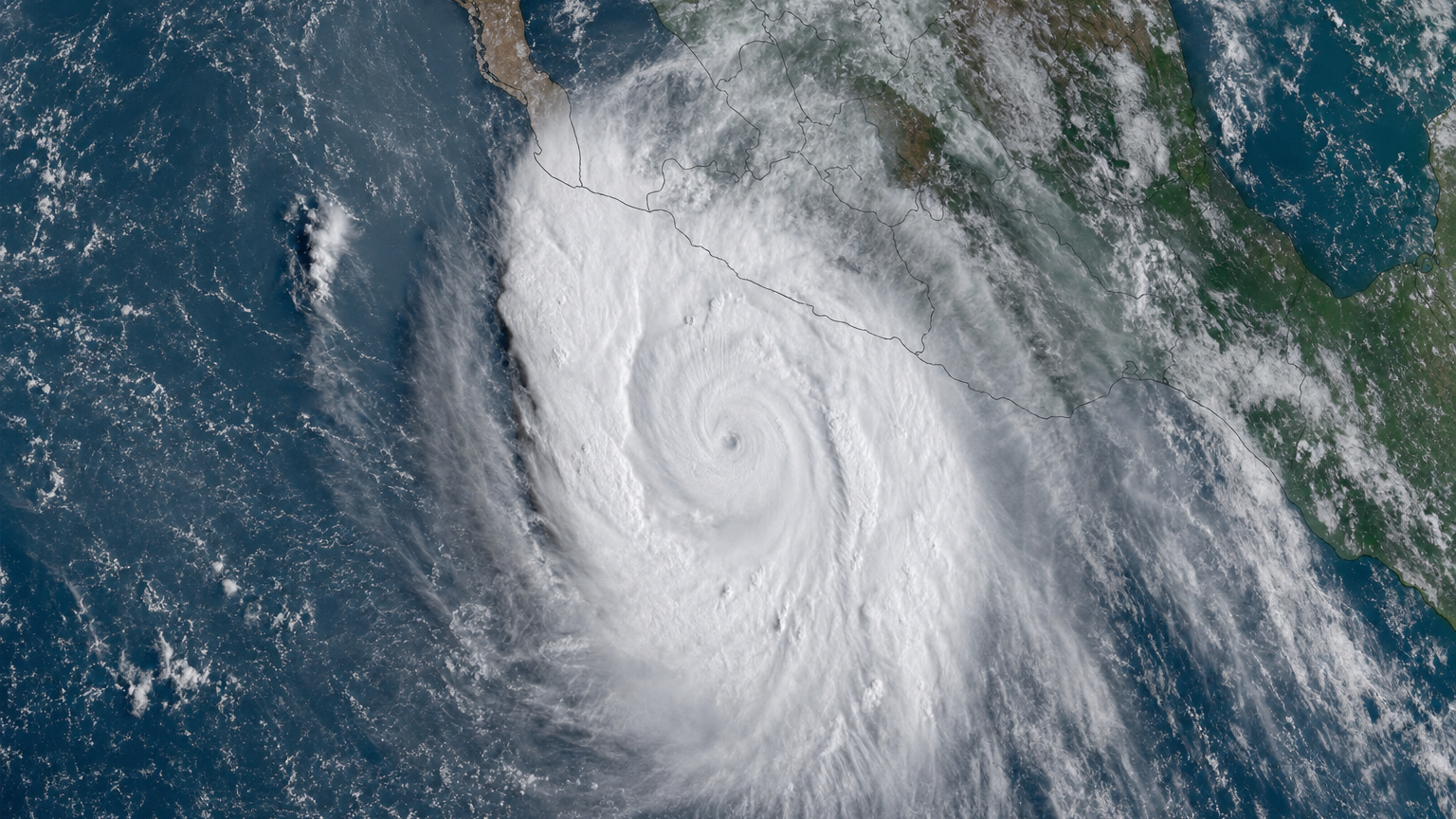
The US National Hurricane Center reported Monday that Hurricane Polo was positioned near 23.6 degrees north and 113.8 degrees west with sustained winds of 115 miles per hour as it moved north-northeast at 9 knots toward Mexico’s Baja California peninsula. Forecasters expect the storm to make landfall late on September 28 or early on September 29 as a major hurricane before crossing the Gulf of California and striking mainland northwestern Mexico. According to the center’s latest advisory, tropical storm and hurricane conditions will spread through the region while generating a dangerous storm surge in areas of onshore winds.
A Reuters dispatch from late last week noted that Polo had regained Category 5 intensity with maximum sustained winds near 180 mph before beginning a gradual weakening trend as it moved over cooler waters. The storm has already triggered rough surf, heavy rains and evacuations along southwestern stretches of Mexico’s Pacific coast, where powerful waves damaged beachfront properties in states such as Colima. One flash flood in Jalisco killed two children when a river overflowed, according to local emergency reports cited by multiple outlets.
Mexican government agencies have deployed thousands of personnel under the DN-III-E military disaster plan, the National Guard and naval forces to support affected areas from Guerrero northward to Baja California Sur. CONAGUA prepared 21 emergency care centers, 717 brigade units and 865 disaster management teams while around 2,000 electrical workers were positioned to restore power outages expected after landfall. Authorities opened more than 160 temporary shelters in Baja California Sur alone and dozens more across Guerrero, Michoacán, Colima and Jalisco, with red flags raised on Acapulco beaches and classes suspended in multiple municipalities.
National Hurricane Center projections indicate Polo will drop 4 to 8 inches of rain across Baja California Sur with isolated totals up to 12 inches, conditions that could produce life-threatening flooding and mudslides especially in mountainous terrain. Earlier in the storm’s approach, coastal sections of Guerrero and Michoacán received 4 to 8 inches while Oaxaca, Colima and Jalisco saw 2 to 4 inches according to accumulated data from the weather agency. The system has also generated large swells likely to cause hazardous rip currents and coastal flooding along the entire Pacific coastline through the coming days.
President Claudia Sheinbaum stated during a regular briefing that while Polo is not forecast to strike southern population centers directly, residents along the entire Pacific seaboard must remain vigilant against flooding and overflowing rivers. The storm’s path parallels a region still recovering from past major cyclones, including several that have struck Guerrero in recent years and caused extensive damage in Acapulco. EL PAÍS reporting highlighted how the rapid intensification of Polo, which saw wind speeds increase by more than 50 mph in under 24 hours, underscores the warming trends in eastern Pacific waters that fuel such powerful systems.
Forecasters tracking the basin have identified the potential for a new tropical depression to form in Polo’s wake later this week, which could bring additional rainfall to already saturated ground in western Mexico. In Baja California Sur, 17 flights were delayed at Los Cabos International Airport as winds and rain increased over the weekend, according to airport officials. The National Hurricane Center urged residents to finalize preparedness plans immediately because further updates may come too late once tropical storm conditions reach the coast.